wave

“We really designed this project specifically to benefit juvenile salmon.”

Matt Van Ess of the Columbia River Estuary Study Taskforce 

It started as a trickle of water slowly pushing dirt and twigs across fresh mud. Then, drawn inexorably by the rising tide, the trickle becomes a stream and the stream a torrent.

Within a few short minutes, some 33.5 acres at Otter Point in the Lewis and Clark National Historic Park were reconnected to the Columbia River estuary and its tidal flows for the first time in more than a century.

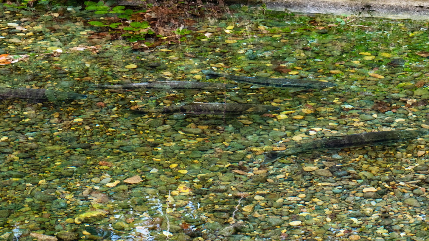
The project, funded in part by the Bonneville Power Administration, transformed a tract of land used to store dredged material from the Columbia River into wetlands that provide vital habitat and food for juvenile salmon and steelhead from upper reaches of the Columbia River.

Only hours prior, Matt Van Ess of the Columbia River Estuary Study Taskforce (CREST) stood atop a newly constructed piggyback levee adjacent to Otter Point to observe the final pieces of work before the breaching of the original levee. CREST is a voluntary, bi-state council of local governments from Oregon and Washington.

“We really designed this project specifically to benefit juvenile salmon,” Van Ess said. “They will come in with the tides. The food for these fish is in wetlands like these.”

The piggyback beneath Van Ess’s feet was necessary to continue to provide the Congressionally authorized level of flood risk mitigation for adjacent properties provided by the system of dikes along the Columbia River. To make the change to the existing levee, CREST worked with the Portland District of the U.S. Army Corps of Engineers on what would be the District’s first major modification, a Section 408, for a levee covered by the federal Public Law 84-99 program.

“When they built these dikes, the estuary lost a lot of area for fish to grow up,” said Don Leach, the Superintendent of Clatsop County Diking District 11. “This project is going to get quite a bit of land back into the estuary. I think it’s going to help.”

The rising tide begins the process of reconnecting 33.5 acres of wetland at Otter Point in the Lewis and Clark National Historic Park on Sept. 20, 2012. The land, part of the historic tide channel, had been cut off from the Columbia River estuary for more than a century.

Hand-built dikes had been originally constructed in the area at the turn of the 20th Century to protect dairy farms and cattle pastures as well as burgeoning timber industry interests. In the 1930s, the Corps would be charged with establishing flood risk mitigation structures in the Columbia River Estuary. The Corps built substantially larger dikes and turned them over to local diking districts mandated with maintaining the structures.

Van Ess said the cooperation of the local diking district was vital for any habitat restoration work to proceed.

At Otter Point, the fish and tidal flows will traverse a series of five breaches along the dike. The high tide rises an average of eight feet in the area. In extreme high tides, the rise can be 12 feet. The breaches along the dike will allow easy access to the recently reconnected wetlands. The project was designed to avoid creating currents that can prevent fish from entering this vital habitat.

“The estuary is seen as a collection area, a potential resting spot for salmonid species of upper river stock,” said Jason Karnezis, the Fish and Wildlife Project Manager for the BPA. “We’re opening up more area for water to flow and system connections to take place. Rather than this area – these 33.5 acres – being isolated, there is now greater connection to tidal flows.”

Improved connectivity and tidal influence allows for greater food production for fish while providing cool water habitat for salmon as they migrate to the ocean.

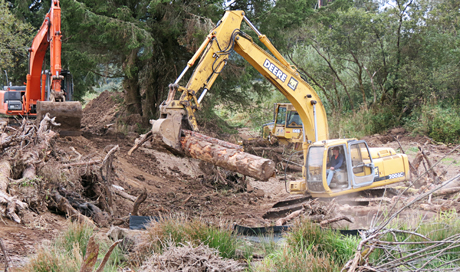
Atop the old levee, the steel gray haze common to the Pacific Northwest could not cloak the clunks, whines and grinding of heavy machinery. A cluster of logs and felled trees crackled as they were snatched up in the steel claw of an excavator and placed along the bank.

“So much of the wood in the estuary has been removed,” Van Ess said. “Historically, there was a lot of this wood in the floodplain. We’re using the wood for habitat complexity – the idea is that it provides cover for the fish, but it needs to be planted down lower to the tides.”

While some logs are secured into the wetland bottoms, much of the wood is simply strewn about the wetland in clumps with the expectation it will move around and mimic natural processes.

In addition to the timber, CREST also cut deep gouges into the new wetland to give the water several paths of travel throughout the area. With all of the dredge material placed on the land over time, the elevation of the land had become higher.

“We knew that we needed to do some active channelization, so that this land can be flooded on a daily basis with the tides,” Van Ess said.

With the land in question owned by the National Park Service, the federal agency played a key role in the project and will provide the ongoing maintenance to the wetlands.

“This project has been fantastic,” said David Szymanski, the superintendent for the National Park Service’s Lewis and Clark National Historic Park. “In addition to our commitment to the fish, we’ve been able to recreate the historical scene and marsh land near Fort Clatsop.”

Fort Clatsop is the site where the famed Lewis and Clark Corps of Discovery encamped during the winter of 1805-1806. Back then, Fort Clatsop was a high point of solid ground surrounded by wet marshland. Otter Point is on the northern boundary of Fort Clatsop. With the project site reverting back to wetland from pastureland, park visitors will be able to experience the area as Meriwether Lewis and William Clark once had.

Additional funding agencies at Otter Point include the Lower Columbia River Estuary Partnership, the U.S. Fish and Wildlife Service, the Oregon Watershed Enhancement Board and the National Oceanic and Atmospheric Administration. CREST will provide ongoing monitoring at the site to ensure benefits are being realized in juvenile salmon.

“Otter Point is a really good example of what we’re hoping to get from other projects,” Karnezis said. “Conceptually, we’re looking to continue projects that promote connection and exchange. When you reconnect lowlands to tidal flows, you fundamentally change and increase wetlands, which are all good things for salmon.”

The project will help to leverage work done throughout the Columbia River Basin for salmon and steelhead as those fish migrate through the estuary and can draw benefit from the improved habitat as well as increase survival rates. The project furthers the overall efforts of the BPA, Corps and Bureau of Reclamation to implement the NOAA Fisheries’ biological opinion on protecting salmon and steelhead listed under the Endangered Species Act as the fish traverse the Federal Columbia River Power System.

For Van Ess and many of those working with CREST and habitat restoration in the estuary, this is the culmination of a long journey, a vision finally coming to fruition.

As the water began to flow into Otter Point, Van Ess paced the piggyback levee with his cell phone.

“You’d better get down here,” he gushed into to other members of CREST and the project sponsors over the phone. “It’s happening. It’s happening now.”

Related News

BPA funds Klickitat Hatchery modernization project

BPA ratepayer dollars support the modernization of a 75-year-old hatchery on the Klickitat River in Washington. Once complete, the renovations will allow for the release of 200,000 additional spring chinook salmon annually.